
Long way down
Day 10. 9/13/13
The atmosphere is a hell of a thing. Long ago in grade school, they tried to mold my mind to grasp the scientific concepts of it all. I'm by no means an invalid. I even enrolled in, appeared sparingly in, and barely passed Atmospheric Science in college (It was at 8am with an old man wielding a more mono-tone voice than Ben Stein). Regardless, or, if you are an invalid- irregardless, I know a little bit about a little bit.
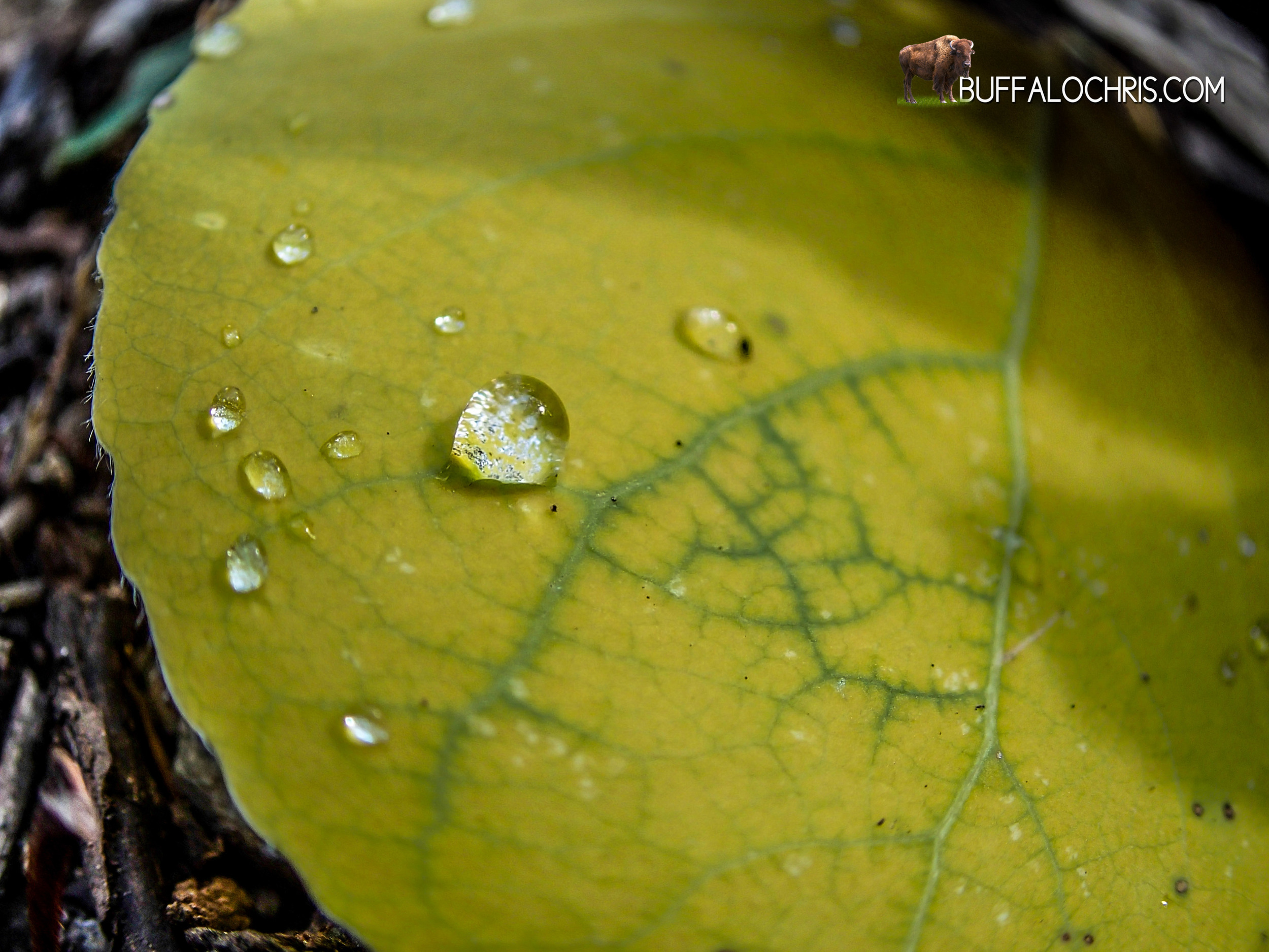
Our tent was (and still is today) made of lightweight nylon, mesh, some stitching, a few plastic tabs. On this morning, every single square inch of the tent was soaked with water, yet it did not rain. The outside of the rain fly was saturated. The inside of the rain fly was drenched. With the lightest breeze, zipper pull, or shake of the tent, droplets would fall onto the mesh and then onto us.
A decent lesson was taught. In times of moisture producing weather, try not to camp in low river/creek drainages. Truthfully there was no way around it for our circumstances. Lindsey was injured, I was slower than a fat kid chasing broccoli, we had to camp where we did. It didn’t matter whether the weather was pristine or brutal.
As usual, Lindsey had gotten up before I did and left the tent. In my slightly conscious and always-alert-for-bear-fights state, I heard her groaning and cursing aloud. "Mmm. It's warm in here." I probably thought. When Lindsey wiggled her way out of her door...my thoughts shifted. In the world of backpacking tents, getting in or out without touching anything is impossible. It would be like Micheal J. Fox beating Operation. Doable, but ain't nobody got time for that.
She crawled out of the tent and little droplets thunked on the mesh. They paused their descent there before squeezing through the fine mesh holes. Tiny frigid droplets hit the little amount of face skin that I couldn’t cover. So it was time to get up. Cold, slightly achy, and dissatisfied with my lack of 9+ hours of sleep I put on my Patagonia Down Sweater and started to surgically remove the rain fly and not drench everything inside the tent.
The careful act took a good few minutes, but I was fairly proud with extraction. It was not perfect, but with Lindsey off in the woods, I felt I did well. Trouble was that the sun rises in the east. And to our east- A huge ridge that towered 800 feet above us. We would be in the shade for a while. I laid out the rainfly on some exposed granite that was free of dirt, needles, twigs, sand. I left the rest of our stuff that had invariably gotten varying degrees of wet inside the tent to dry. We waited. The sun came over the landscape and graced us with its warm, drying rays around 10 or so.
Another timely start.
After basking in the sun with the nylon parts of the tent, we were all warmer, dryer, and trail ready.
Today was another pass day. Selden was standing between progress and us. From our camp, at roughly 9320 feet, Selden was 1560 feet above us and 5 miles away. Not a taxing day at all compared to some of the passes. On paper, Selden looked respectable but doable. However, today was also a 12 mile day. Our destination was Muir Trail Ranch for our main resupply of the trip: a 5 gallon bucket stuffed full of 25 pounds of food awaited us. MTR was back in the lowlands at 7790ft though. Home was 12.2 miles away.
Despite the injuries and whatever made me basically crawl up the trail the day before, we were in good trail shape. I didn't pay a second thought to throwing my 30ish pound backpack over my head. I didn’t give a first thought to carrying it up and over rocky mountain passes. It felt normal. Blisters were not an issue. We'd taken good care early on to prevent and care for the few that we did get. Our feet hurt sure, but nothing more than that. 10 miles seemed not easy nor hard- It seemed like a fairly short, manageable distance that we could easily make. How long it would take was dependant partly on terrain and partly how badly we wanted to get there. It's a good feeling.
It was good feeling better. Lindsey was doing okay. I was back to my normal super-human self. Faster than a speeding sloth, more powerful than a mini-bike, able to hike up 10" in a single bound. And we went.
This was a beautiful part of the trail, and the moist start had turned into a beautiful morning. The sun baked off the dew and condensation that befell the yellow and tan vegetation that was past its seasonal prime. Trees were still green, gorgeous, and gargantuan. We stayed next to Bear Creek on our way up to Upper Bear Creek Meadows and then Rosemarie Meadow shortly after. The JMT meets two little spurs at Rosemarie Meadow. One goes west, one goes east. Each about 2 miles, these side trails lead to lakes that look fairytale-esque on paper. Give more time, it's high on my list of places to go back and explore.
Marie Lake Basin
Then Marie Lake. Oh, Marie Lake. As we went on past the aforementioned junction, the vegetation recedes, the granite and talus dominates, and another quintessential Sierra lake comes into view. Of course, Marie Lake was my new favorite place of all time. It was much smaller than Thousand Island Lake but little islands jutted through deep translucent azure waters in a similar way. The rocky micro land masses had a tree or two on them, grass grew on a few.
The trail goes right by the western side of the lake so it was a convenient place to stop, break out the steri-pen, and replenish our water. As we sat in the clear sunshine and high mountain air, a trail crew of US Forest Service workers walked by. The abnormally tall bearded one of the group stops and says hi, his greeting just semantics because saying "Show me your permit" is too direct. By sentence two we've made it to the let's-see-your-papers phase.
"Do you all have a permit?"
"Yes." I say.
7-9 second strange pause as I just sit there.
"Can I take a look?" Tall beard says.
And I open my pack back up, dig around the mesh pocket under the lid and pull it out. He looks at it and says thanks. He was a cordial person who informed us that a good many people actually go on the full JMT without permits. After a short chat, he went to catch up with the rest of the workers. The crew was off to the Hooper lakes, I believe, to deconstruct illegal camp sites. There is no trail to these lakes; it's all route-finding.
Lindsey and I wrap things up and aim our bodies for Selden Pass, which we can see from the lake we've been resting at. So far we've made quick work of the 5 miles behind us. It is a short 300-foot climb through a saddle in the mountain ridge and we get a view of the terrain before us from atop Selden Pass. A vast expanse of mountains building a wall on the horizon. Light blue skies with white clouds. Dark green valleys, shiny blue lakes. The first of which is right on the trail about 1 mile away. Heart Lake.
I hike to it at a moderate to grueling pace (on meager rations) as Lindsey follows. We're still above tree line and the landscape is all talus fields, granite boulders, loose scree on the sides of the trail. We had not seen a Pika on this trip, and I'd not seen one ever. However, every now and then when we'd hike through a rock debris field like I was going through now, I'd hear a really high pitched "CHIRP." I deduced this was the sound a Pika made.
Shortly before Heart Lake, the JMT bottle necks through a little canyon of sorts. Decently steep rock fields are on either side. CHIRP! I hear the sound, and I stop. Because I'm going to outsmart these jerks. I am going to stand perfectly still and do nothing until the rodent reveals itself. Lindsey comes skidding down the trail behind me and stops as well. I simply motion her to be quite in an "I'm hunting wabbits" kind of way. I'm ready and prepared.
A little ball of fluff hops on a rock right in front of me and stares at me. "CHIRP!" And it sits there, 12 or so feet away on a rock that's nearly at eye level. I fumble for my camera and telephoto lens, knowing that the big ass tan cotton ball with ears will bolt. Surprisingly, it stayed there. For a long time. Sadly, probably conditioned to expect food from humans. Or maybe it just wanted to say hi. Without a doubt, cutest thing on the whole trip.
Heart Lake comes along. And it was the most beautiful place I'd ever seen in my whole entire life.
I paused for a bit to see some marmots scurrying their heft away from me in the distance. I took in the scenery--an actual heart-shaped lake with the most gorgeous colors. Its inlet was a shallow alluvial fan of rust and tan colored sediment that dropped off into the deep blue unknown. A few hundred feet down to the tip of the heart was the outlet stream that seemed to drop off the face of the mountains.
Lindsey didn’t stop for as long so I carry on to catch up. After all, I'm the bear defense system.
The elevation keeps dropping and a larger bowl of lakes appears in the near distance. These are Sallie Keys Lakes, maybe 1 mile beyond Heart Lake.
I'll be damned if this wasn't the most beautiful place I'd ever seen.
Truthfully, with the benefit of hindsight, retrospect, and deep analysis, Sallie Keys is in the top 3 of all the places I saw on the trail. And I don't have a formal 1-2-3, but it's on the short list for sure. Absolutely insane area surrounded by mountains. The JMT tightropes a little ridge between two of the lakes and meanders through a perfect conifer forest. It's silly.
We stopped at the northern-most lake and had a snack. I finally broke open the Salmon I'd bought at REI. Best stand-alone thing I ate on the trail.
Further south beyond Sallie Keys Lakes, we dropped back into big forests for a few miles and then hit serious switchbacks that descend into the San Joaquin River Valley where Muir Trail Ranch lies. These short, exposed switchbacks were reminiscent of Tully Hole. Steep, incessant grades zig-zagging down a shrub covered mountain side.
The skies threatened rain with their gunmetal clouds. The sun, which was hidden behind the larger masses of cloudery, gave its best to fight through. Beams of light radiated down into the river valley where we were headed. Perhaps shining light on our future camp site. We marched down the gradient as some rain drops began to fall.
The rain fell incrementally harder so I broke out the rain jacket and we hiked a bit more. At the end of a switchback I was on, right before it made the 350 degree turn to continue on down, a large pine tree grew. Having firsthand experience at how effective these guys are at being a shelter in a light rain shower, I plopped down and leaned against the tree. We waited for the shower to pass as we took in the scenery. Within minutes, the hardest of the rain had stopped so we kept on hiking down and down and down.
We reached the junction where the switchbacks end and the JMT veers east, but Muir Trail Ranch was another .9 mile section of even steeper, shorter switchbacks. Somewhere in this section, Lindsey made a game of kicking a pinecone down the trail. For over a mile, she kicked the same fat brown pinecone until it was decimated.
She seemed a little down when she was finished. And since she had to be in front of me to play this game, I decided to help her out. From about 20 feet behind, I teed off on a particularly meaty looking cone that was on the forest floor. I punted it hard and far. Lindsey saw it go flying past her and land right in the trail. She screamed "Yeah!" with elation and started kicking again, the new pinecone rejuvenating her obviously riveting game.
Closer to MTR I just stopped. I wasn’t tired. But with backpack on, having just hiked down relentless switchbacks and dropping about 3000 feet, I picked up a pine cone and punted it. And then I picked up another one. And I punted that one. And for a couple of minutes, I went crazy picking up and subsequently kicking pine cones, seeing how far and hard I could hit them. It was awesome.
We'd made it to MTR. They were closed for the season aside from resupplies and didn’t have a kitchen, food, or lodging, but it wasn’t a big deal. There was a prime camp site nearby so we set up and went to explore our surroundings in the final hour of light that we had.
The public hot spring. Also home to Swamp Thing.
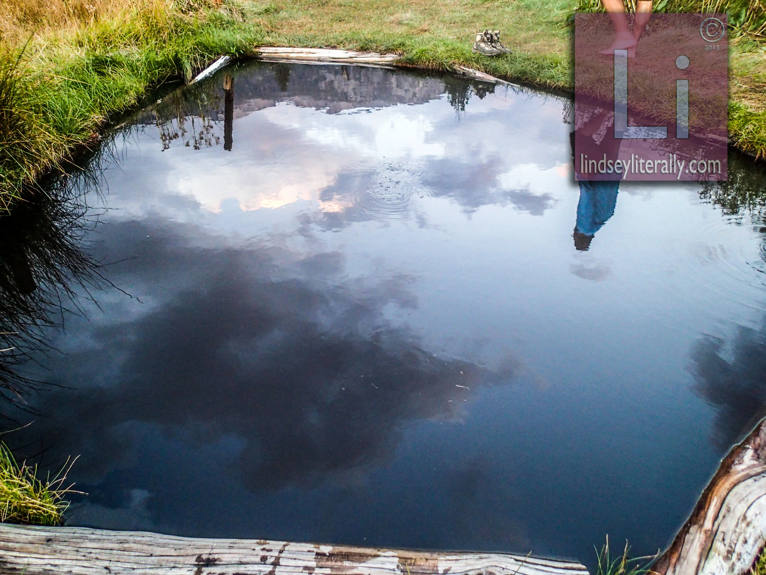
The book told of hot springs nearby. Getting to them is the hard part. The land and trail system in this area is a puzzle of public and private incongruencies. You can cross the shallow cobble bottomed river and make it to the hot springs on the other side, but there is more than one hot spring. And you can't go to the private ones. You can go to the public one that is on federal land, but you have to hike a circuitous, public land back way to get to it lest you trespass. We ended up crossing the river at the easiest looking spot. This, of course, is the private area. It is not well marked, though. There are two hot springs here. One is a clear bathtub sized pool with a sign marking it as private land. The other is a black water hole that's warm. Even further south, past an old fence with a "US Forest Service" sign is the public hot spring: a sulfur scented, soil stained, watery bath. There's 0 visibility in the water so I have no idea how deep it was. Part of me feared it was a pit or portal into an alien world and that if I got in, I wouldn't be able to touch the bottom and a swamp monster would grab my leg, take me down, and that'd be the end. It did feel amazing when I dipped my foot in. Maybe the waters are clearer at other times. It wasn’t in the cards for us though, so we went back to camp and slept 200 feet outside the gate of MTR. In the morning, we'd grab our yellow McCoy's bucket full of food and then decide what to do.
Lindsey was better, but still in big pain. For the past few days, there was talk of ending the hike via a side trail. We were leaning towards hiking out because of her ankle pain.
I was still in pain too. My ankle hurt just about every step of the way but I was used to it and just raised my pain threshold. Sometimes it was debilitating for us both. I checked Lindsey's foot. The area between her foot structure and her tendon was soft and puffy with what appeared to be fluid.
I was hoping rest would help.
The San Joaquin bubbled over ancient round stones that made its river bed. The forest fell silent. The night was bright with the moon almost at full throttle. The atmosphere settled to stillness around us and we were sung to sleep by pine needles lightly falling around us with rarity.
Tomorrow would be a game changing day no matter what. Tomorrow would be decision day. I went to sleep knowing that tomorrow would be the first day of the end.
Notes from the Trail
9.13. WOKE UP TO EVERYTHING WET.
RAINFLY IN AND OUT WAS SOAKED FROM DEW.
BAGS DAMP. BEAR CANS WET. EVERYTHING DAMP.
CAMPED IN A RVR VALLEY SO NO DIRECT SUN TIL 930
------
JUST SET UP OUTSIDE MTR. BAG MOIST.
BEAR CAN WORE HOLE IN BACKPACK
GOT A LIGHT SHOWER WHILE HIKING TODAY.
CHECKED OUT SOME SHIT HOT SPRINGS.
WARM NIGHT SO FAR.
LINDSEY HAS FLUID IN LEG/ANKLE
SHE WANTS TO FINISH BUT WILL BE ALMOST IMPOSSIBLE
MY TENDON SQUEAKS. WEIRD.
MTR CLOSED FOR SEASON EXCEPT STORE.
WAS LOOKING FORWARD TO BATHROOMS.
WILL PROBABLY EXIT IN BISHOP SOME 3-4 DAYS AWAY.
DID 12.2 MILES TODAY IN 8.5 HOURS OR SO
SHITTY WET MORNING SLOWED US DOWN.


Bonus Pika